Loaded with lakes, rivers, caves, temples, waterfalls, national parks, historical sites, picturesque villages and mountain vistas, the road to Sangkhlaburi is one of Thailand's most spectacular. Kanchanaburi town is known for its rafthouses and World War II sights, but for the very best of this enormous province, get some wheels and head to where the air is cool and the scenery sublime.
Route 323 meanders for some 225 kilometres from Kanchanaburi town to Sangkhlaburi (see map). With numerous blue signs pointing to dozens of attractions, a drive down the road can feel like checking out a menu of things to see and do. The best approach is to keep it slow, put on your explorer cap and stop often to climb a mountain, swim beneath a waterfall and sample the local food. The drive takes around four hours with no stops, so plan on at least a day or two each way. Add a minimum of two more days in Sangkhlaburi itself and the adventure can easily last a week or more.
Getting there is half the fun.
About 35 kilometres north of Kanchanaburi town off Route 323, Prasat Muang Singh is thought to have been the westernmost outpost of the Khmer empire. Surrounded by mountains and laid amid frangipani, jackfruit and banyan trees on tranquil grounds, these ancient ruins are a change from the area's many World War II sights. After a climb through the laterite temples, head to nearby Tham Krasae for soaring views of the River Khwae valley.
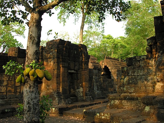
Prasat Muang Singh with no one else around.
Continuing northwest, 323 straddles sugar cane fields beneath jagged mountain peaks until it reaches Sai Yok Noi waterfall and the end of the Death Railway line at Nam Tok station. While more impressive waterfalls are found further up the road, Sai Yok Noi makes for a refreshing break and is a good spot to score a cheap Thai lunch -- don't miss the locally grown tamarind. Not far from here, it's possible to hike to Wang Badon cave or take a detour northeast to the majestic falls of Erawan National Park and cavernous Phra Tat cave.
Another 30 kilometres further northwest brings you to Hellfire Pass, the province's most moving and extensive World War II sight. In 1942-3, Allied POWs and Asian forced labourers laid tracks for the Burma-Thailand railway, better known as the Death Railway, a transport route used by the Japanese military during the war. More than 100,000 lives were lost during the railway's construction due to starvation, disease, accidents, exhaustion and beatings by Japanese guards.
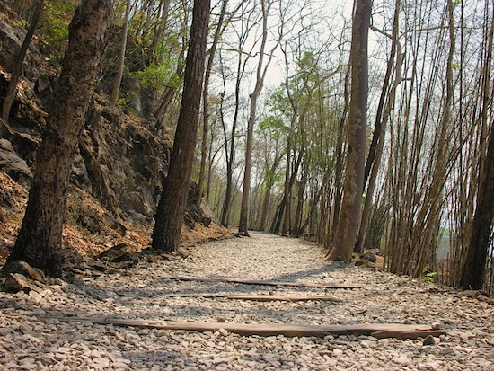
Remnants of the railway at Hellfire Pass.
A section of the railway known as Hellfire Pass was considered by POWs to be the most difficult to construct due to the need to clear huge outcrops of rock on rugged mountain slopes. Visitors can peruse the outstanding museum and hike a memorial trail that spans several kilometres where the track was laid, including several stretches through rock cuttings made by the prisoners.
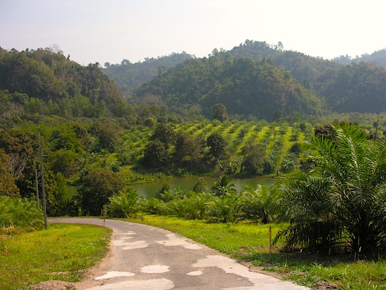
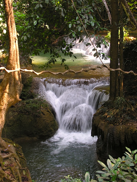
It can get extremely hot in Kanchanaburi province, and you'll probably be ready for a swim after a walk along the Hellfire Pass memorial trail. Conveniently located some 20 kilometres further north, Sai Yok National Park is the perfect spot to cool off. The River Khwae Noi cuts through the park and Sai Yok Yai waterfall cascades from atop a cliff directly into the river. After a jungle hike, dive into the clean water and swim up to a floating restaurant. National park accommodation, both floating and on land, is also available should you be ready to call it a day.
Sai Yok Yai National Park -- yes, I think we'll crash here tonight.
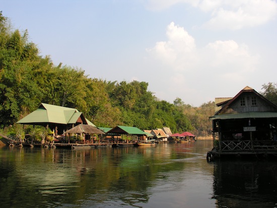
Sheltered by limestone cliffs further up the River Khwae, the friendly village of Thong Pha Phum offers a taste of the area's rural culture. Head straight into town to sample locally caught grilled river fish, Mon-style curries and fresh picked fruit at the riverside market.
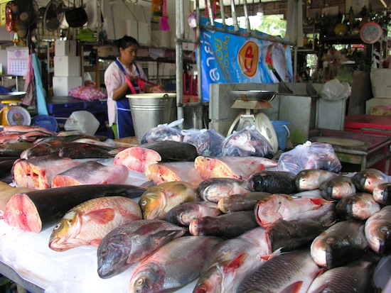
Fresh catches in Thong Pha Phum.
You might then take a detour to mountaintop Wat Tha Kha Nun on the east side of the river, or Vajiralongkorn Dam just north of town. Built in the mid-80s, the dam formed the mountain-rimmed Vajiralongkorn Lake which extends all the way north to Sangkhlaburi town. Perched at the top of the dam, a lookout affords fantastic views of the lake to the north, the valley to the south and the vast green mountains that form the Burma border to the west.
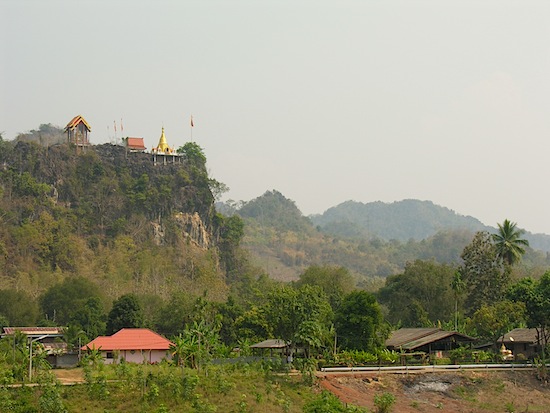
Wat Tha Kha Nun as seen from Thong Pha Phum village.
If you're up for a more intrepid adventure, strike out west to the border outpost of Pilog and Thong Pha Phum National Park; bring plenty of gas as the road winds for miles through nothing but steep mountains covered in old growth jungle. Along with tropical plants and wildlife, several coffee plantations thrive in the Thong Pha Phum area. Some of the finest brew we've found anywhere in Thailand was at a roadside stand near Thong Pha Phum.
North of Thong Pha Phum village, the scenery becomes increasingly dramatic and 323 lives up to its billing as one of Thailand's most spectacular roads. The sparsely travelled two-lane thoroughfare slides past forested mountains, towering bamboo trees and rural temples with natural caves as meditation halls. Take it slow and soak up the cool air.
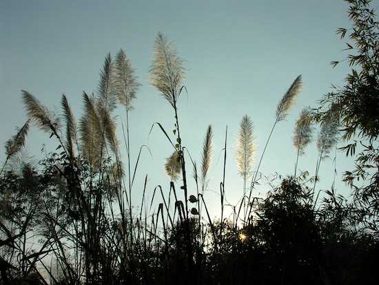
Even bathroom breaks are beautiful here.
The road periodically emerges into countryside villages with modest homes clustered on rafts over Vajiralongkorn Lake. At this point, the drive is so enjoyable that you might not be too concerned with attractions, but a few more natural wonders are worth stops before arriving in Sangkhlaburi.
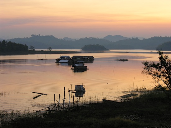
We're not in Bangkok anymore.
With several sets of falls that empty into crystal clear emerald pools and conceal secret nooks in the rocks, Krueng Krawia waterfall is an excellent venue for a dip. If you prefer to wade in steaming hot water, take a side trip to nearby Hin Tat hot springs.
Krueng Krawia -- a one-minute walk from the main road.
Further north, Khao Laem National Park features hiking trails and impressive waterfalls of its own, and nearby Pom Pee viewpoint is a relaxing place to sit back and dangle your feet in the lake. If you arrive in the late afternoon, be sure to stick around for sunset.
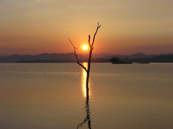
Pom Pee also has a few bungalows for rent.
From here, Sangkhlaburi is only 35 kilometres further north, reachable after a steep climb higher into the mountains. Although the road is one of the area's greatest highlights, it doesn't overshadow the town itself. Sangkhlaburi's relaxed atmosphere, colourful Mon village and boat trips to a sunken town make it an unforgettable destination. Its hand-made wooden bridge recently collapsed in a storm, but a temporary floating bridge has replaced it for now.
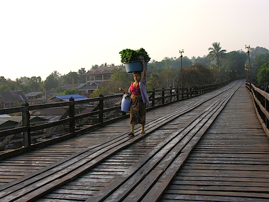
Sadly, this bridge is no more, but it'll no doubt be back.
If there's anywhere in Thailand to splurge on your own wheels, it's Kanchanaburi province. Cars or motorbikes can be rented in Kanchanaburi town. Many attractions are situated immediately off Route 323, making it also possible to undertake the trip by bus and/or minibus. These pass about once per hour from early morning to late afternoon and will typically pick up passengers anywhere along the road. To see what the trip might be like by motorbike, check out Fearful Adventurer's account.